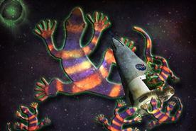
In our ongoing fascination of sending weird things into space, scientists launched an orbital satellite filled with geckos in order to better understand mating in zero-gravity. The satellite has since gone rogue.

During a satellite appearance on The Ellen DeGeneres Show, Madonna makes a heartfelt plea to end bullying in America.

During a satellite appearance on The Ellen DeGeneres Show, Madonna makes a heartfelt plea to end bullying in America.
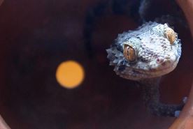
In our ongoing fascination of sending weird things into space, scientists launched an orbital satellite filled with geckos in order to better understand mating in zero-gravity. The satellite has since gone rogue.
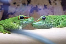
In our ongoing fascination of sending weird things into space, scientists launched an orbital satellite filled with geckos in order to better understand mating in zero-gravity. The satellite has since gone rogue.
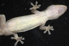
In our ongoing fascination of sending weird things into space, scientists launched an orbital satellite filled with geckos in order to better understand mating in zero-gravity. The satellite has since gone rogue.
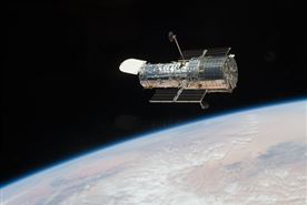
Low-Earth Orbiting satellites are designed to withstand a regular onslaught of solar energy, but a rare "solar megastorm" could decimate a majority of the fleet.

Low-Earth Orbiting satellites are designed to withstand a regular onslaught of solar energy, but a rare "solar megastorm" could decimate a majority of the fleet.

After typhoon Haiyan smashed into the Philippines, citizens from around the world worked around the clock to analyze satellite imagery, generating maps to provide relief agencies with invaluable crowdsourced information.

After typhoon Haiyan smashed into the Philippines, citizens from around the world worked around the clock to analyze satellite imagery, generating maps to provide relief agencies with invaluable crowdsourced information.

After typhoon Haiyan smashed into the Philippines, citizens from around the world worked around the clock to analyze satellite imagery, generating maps to provide relief agencies with invaluable crowdsourced information.
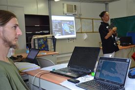
After typhoon Haiyan smashed into the Philippines, citizens from around the world worked around the clock to analyze satellite imagery, generating maps to provide relief agencies with invaluable crowdsourced information.

After typhoon Haiyan smashed into the Philippines, citizens from around the world worked around the clock to analyze satellite imagery, generating maps to provide relief agencies with invaluable crowd-sourced information.
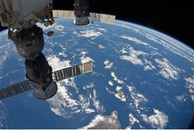
The ISS is a habitable artificial satellite in low Earth orbit. It has been continuously occupied for over 12 years and has been visited by astronauts and cosmonauts from 15 different nations.
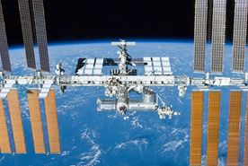
The ISS is a habitable artificial satellite in low Earth orbit. It has been continuously occupied for over 12 years and has been visited by astronauts and cosmonauts from 15 different nations.
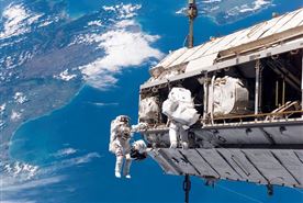
The ISS is a habitable artificial satellite in low Earth orbit. It has been continuously occupied for over 12 years and has been visited by astronauts and cosmonauts from 15 different nations.

The ISS is a habitable artificial satellite in low Earth orbit. It has been continuously occupied for over 12 years and has been visited by astronauts and cosmonauts from 15 different nations.

CubeSats hitchhike as secondary cargo on launch vehicles—adding to their considerable economic advantage over conventional satellites, which can run $50 to $100 million at the low end.

CubeSats hitchhike as secondary cargo on launch vehicles—adding to their considerable economic advantage over conventional satellites, which can run $50 to $100 million at the low end.
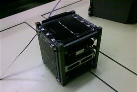
CubeSats—low-cost satellites no bigger than loaves of bread—are coming into their own, performing high-level scientific research. This could be a watershed moment for how science gets done.
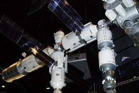
The proposition of in-orbit servicing has to become a reality sooner or later. And not just servicing, but removing redundant satellites from the sky altogether.
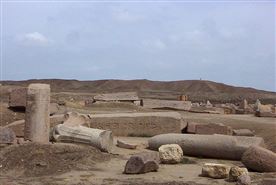
Infrared images taken by NASA satellites have peered below the earth's surface to reveal what are suspected to be pyramids under the ancient city of Tanis.

Infrared images taken by NASA satellites have peered below the earth's surface to reveal what are suspected to be pyramids under the ancient city of Tanis.

Two German radar satellites are flying within 350 meters of each other as they orbit the globe in an effort to creating a seamless and incredibly accurate 3D map of the Earth.